Home Sensing Primer Glossary Physics Related Technologies Acknowledgements
A Brief History of Remote Sensing
Remote sensing has been with us for longer than you may think. In the 1600s, Galileo used optical enhancements to
survey celestial bodies. (He also used his optical equipment to observe merchant ships arriving in harbor, capitalizing on
this information to modify
his investment strategies to anticipate changes in the rapidly fluctuating prices of the local commodity markets.) French balloonist and
photographer Gaspard Felix Tournachon attempted (without great success) to perform land surveys in 1859 using photos taken from tethered
balloons. Similar technologies were used for the next four years by the Union forces in the USA civil war, also with unsatisfactory
results.
In the 1880s, Arthur Batut in Labruguiere, France affixed cameras to kites. His apparatus included an altimeter which
encoded the altitude onto the film so the scale of his images could be determined.
The camera shutter was triggered by a slow burning fuse, and his mechanism released a red flag when the shutter had been tripped.
For all this, Batut is considered the father of kite aerial photography, a technique that persists in modern times. At least
one modern preserve manager has a hobbyist interest in attaching cameras to kites for remote sensing applications, but this is still in a
novelty stage of development (S. Eisenhauer, private communication, 2000).
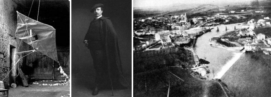
Photographs documenting Arthur Batut's kite, style sense, and imagery of Labruguiere.
By 1903, camera miniaturization had become so advanced the cameras could be attached to pigeons. The most famous avian photographers were the Bavarian Pigeon Corps. The cameras had a mass of 70 gm (2.5 oz), and took photographs every 30 seconds. While their images (that sometimes included wingtips in the frame) were of limited use, the birds looked great in uniforms (see below).
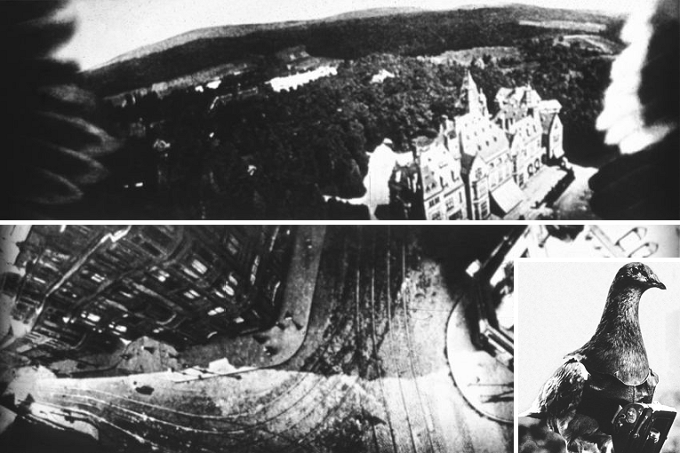
What you get when you put cameras on pigeons. Note the wingtips in the top photograph!
Military applications of remote sensing continued during WWI, and WWII. Remote sensing changed the course of world history
when, during the 1962 Cuban missile crisis, U-2 spycraft detected the installation of intermediate range nuclear missiles in Cuba.
In 1956-1958, W.M. Stinton discovered absorption features in his spectra of Mars that appeared to be consistent with
chlorophyll. This was an interesting application of vegetation remote sensing. However, these observations were later explained as
resulting from an absorption band due to deuterated water.
In 1972, the satellite Earth Resources Technology Satellite (ERTS-1) was launched. Subsequently renamed Landsat, this was the
first of the highly successful Landsat series of remote sensing platforms, the most recent being Landsat 7 (launched 15 April 1999).
Many other remote sensing devices with vegetation monitoring emphases have been flown, including Systeme Probatorie de la Observation
de la Terre series (SPOT, 1986, France), European Radar Satellite (1991), IKONOS (privately owned, 1991), OrbView-2 satellite (1997),
and additional remote sensing devices have been taken into space as payload missions on the U.S. Space Shuttle.
Current remote sensing data are obtained from satellites, high flying aircraft, and low flying aircraft. Each mode of
platform transport has its advantages and its disadvantages.
Now that you have some history under your belt, let us review current technologies for remote sensing...