Home Sensing Primer Glossary Physics Related Technologies Acknowledgements
Instrument profile: Landsat
Landsat is a series of satellites that have been in operation since 1972. Landsat 1, 2, and 3 were of similar optical design. These three
satellites were equipped with a Multi-Spectral Scanner (MSS).
Landsat 4, 5 introduced the Thematic Mapper (TM) in addition to the MSS.
Landsat 7 is the most recently launched satellite, and includes the Enhanced Thematic Mapper (ETM+).
The satellites have been
instrumental in mapping the surface of the Earth for countless remote sensing applications.
| Platform | Launch date | Deactivation date | Remote sensing payloadsa |
|---|---|---|---|
| Landsat-1b | 23 July 1972 | 2 January 1978 | MSS, RBVc |
| Landsat-2b | 22 January 1975 | 25 February 1982 | MSS, RBVc |
| Landsat-3b | 5 March 1978 | 31 March 1983 | MSS, RBVc |
| Landsat-4 | 16 July 1982 | August 1993d | MSS, TM |
| Landsat-5 | 1 March 1984 | Still operational | MSS, TM |
| Landsat-6 | 5 October 1993 | Failed on launch | ETM |
| Landsat-7 | 15 April 1999 | Still operational | ETM+ |
|
aDetails of the relevant are given in the next table on this page. bAlso called Earth Resources Technology Satellite (ERTS) series. cThe Return Beam Vidicom (RBV) was in effect a television camera and was not very useful. dFinally decommissioned in June 2001. |
|||
Usefulness to land managers
Because of the large pixel size (30 m on a side), Landsat 5 and Landsat 7 data are likely to be useful only to those working
on ecoregional/state/national/global scales. Data from earlier Landsat missions have lower resolution and
are even less suitable to regional managers.
Costs and Contacts
http://landsat.gsfc.nasa.gov/index.html--technical information.
http://landsat7.usgs.gov/index.php--ordering data.
MSS data cost approximately $200-300 per scene (185 × 170 kilometers), depending upon volume and level of image processing required;
additional scene discounts available.
TM data cost $425 per scene (170 × 183 kilometers); additional scene discounts available. ETM+ scenes vary widely in cost, depending
upon options selected and number of images requested; a single scene (170 × 183 kilometers) can cost between $200-$600.
Sample images (L7 imagery)
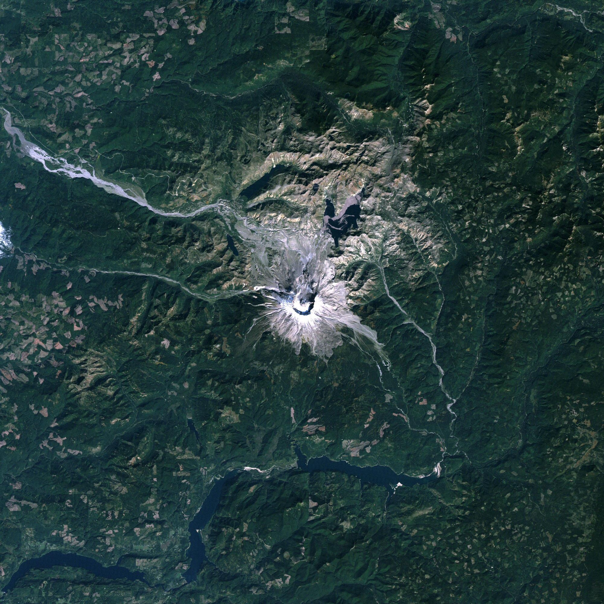 Mt. St. Helens, 28-Sept-2004. |
 Manhattan, Long Island, NJ. |
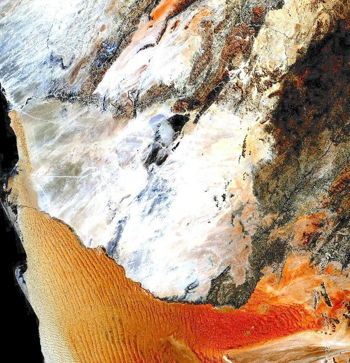
 Namibia, Kuiseb R.; Bands 3-2-1 |
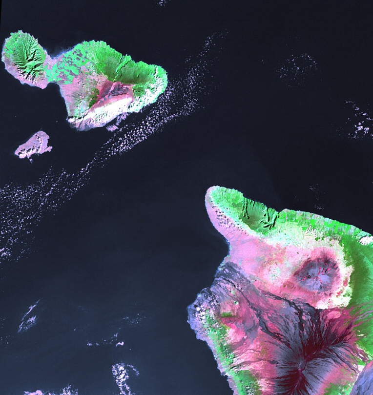
 Hawai'i, Mau'i, Kahoolawe. |
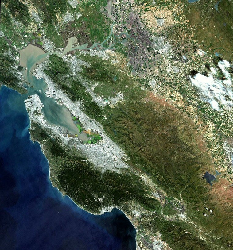 San Francisco Bay, Bands 3-2-1. |
Useful Web Sites
See above.
Technical Specs
| Multispectral Scanner (MSS): Device Characteristics |
Band number | Spectral coverage | Resolution | Scene size | |
|---|---|---|---|---|---|
| Landsats 1-3 | Landsats 4-5 | ||||
| 4 (green) | 1 (green) | 500-600 nm | 79 ma | 185 × 170 km | |
| 5 (red) | 2 (red) | 600-700 nm | |||
| 6 (near-IR) | 3 (near-IR) | 700-800 nm | |||
| 7 (near-IR) | 4 (near-IR) | 800-1100 nm | |||
| aPixel size for these images is 57 ×57 m. |
|||||
| Thematic Mapper (TM): Device Characteristics |
Band number Landsats 4-5 |
Spectral coverage | Resolution | Scene size | |
| 1 (blue-green) | 450-520 nm | 30 m | 170 × 183 km | ||
| 2 (green) | 520-600 nm | ||||
| 3 (red) | 630-690 nm | ||||
| 4 (reflected-IR) | 760-900 nm | ||||
| 5 (reflected-IR) | 1550-1750 nm | ||||
| 6 (thermal-IR) | 10400-12500 nm | 120 mb | |||
| 7 (reflected-IR) | 2080-2350 nm | 30 m | |||
| bThe image resolution for band 6 is 120 m, but the data product is resampled to be displayed with 30 meter pixels. |
|||||
| Enhanced Thematic Mapper Plus (ETM+): Device Characteristics |
Band number Landsat 7 |
Spectral coverage | Resolution | Scene size | |
| 1 (visible) | 450-520 nm | 30 m | 170 × 183 km | ||
| 2 (visible) | 530-610 nm | ||||
| 3 (visible) | 630-690 nm | ||||
| 4 (near-IR) | 780-900 nm | ||||
| 5 (near-IR) | 1550-1750 nm | ||||
| 6 (thermal-IR) | 10400-12500 nm | 60 m | |||
| 7 (mid-IR) | 2090-2350 nm | 30 m | |||
| 8 (panchromatic) | 520-900 nm | 15 m | |||
References
http://www.earth.nasa.gov/history/landsat/landsat.html (and subpages)--accessed 24 Sept. 2004
http://landsat.gsfc.nasa.gov/index.html (and subpages)--accessed 24 Sept. 2004
http://landsat.usgs.gov/index.php (and subpages)--accessed 24 Sept. 2004
http://landsat.usgs.gov/documents/fs02303.pdf--accessed 24 Sept. 2004