Home Sensing Primer Glossary Physics Related Technologies Acknowledgements
Instrument profile: SPOT--Satellite Pour l'Observation de la Terre
SPOT is a privately owned, French set of satellites. The products from the SPOT satellites include panchromatic and multispectral imagery. A "monospectral" product is available, as well as various other derived products.
| Satellite | Launch date | Decommision date | Payload |
|---|---|---|---|
| SPOT 1 | 22 February 1986 | Still active | HRV (High Resolution Visible) |
| SPOT 2 | 22 January 1990 | Still active | HRV (High Resolution Visible) |
| SPOT 3 | 26 September 1993 | Still active | HRV (High Resolution Visible) |
| SPOT 4 | 24 March 1998 | Still active | HRVIR (High Resolution Visible Infra Red) |
| SPOT 5 | 4 May 2002 | Still active | HRG (High Geometric Resolution), HRS (High Resolution Stereosopic Imaging Instrument) |
| Pleiadesa | Not announced | --- | Not announced |
| aThe Pleiades minisatellites will be the next generation of satellites from Spot Image. | |||
Usefulness to land managers
Inexpensive, high quality data. Likely to be useful to those who are satisfied with panchromatic or multispectral imagery.
The SPOT satellites offer a product similar to IKONOS or QuickBird data, but different in the details.
Costs and Contacts
http://www.spotimage.com--The main web site for the parent company.
Overview of prices as of October 2004 are below. Images are available within three days, 1-day rush option is available
at higher rates. Old (1986-2001) archived full scene data is available for 1200 euros.
Other pricing options are available, check their web site for details. Note that in October 2004, 100 euros converts to
approximately US$127. More recent conversions can be obtained here.
| Archived Library Imagesa | ||||
|---|---|---|---|---|
| Productb | Full scenec | 1/2 scene | 1/4 scene | 1/8 scene |
| 20m color or 10m B&W | 1900 euros | --- | --- | --- |
| 10m color or 5m B&W | 2700 euros | 2025 euros | 1350 euros | 1020 euros |
| 5m color | 5400 euros | Not available | Not available | Not available |
| 2.5m B&W | 5400 euros | 4050 euros | 2700 euros | 2040 euros |
| 2.5m color | 8100 euros | Not available | Not available | Not available |
| Programmed Imagesd | ||||
| 20m color or 10m B&W | 2700 euros | --- | --- | --- |
| 10m color or 5m B&W | 3500 euros | 2825 euros | 2150 euros | 1820 euros |
| 5m color | 6200 euros | --- | --- | --- |
| 2.5m B&W | 6200 euros | 4850 euros | 3500 euros | 2840 euros |
| 2.5m color | 8900 euros | --- | --- | --- |
|
aPrices are for level 1A, 1B, or 2A processing. Processing levels are described below. bThe parameters below are pixel size and color vs. black and white.. cA "scene" is 60×60-80 km, depending upon the viewing angle. dThese are new images that the satellite must be tasked to obtain. |
||||
Sample images
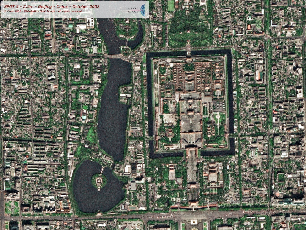 2.5m sharpened color Beijing, China |
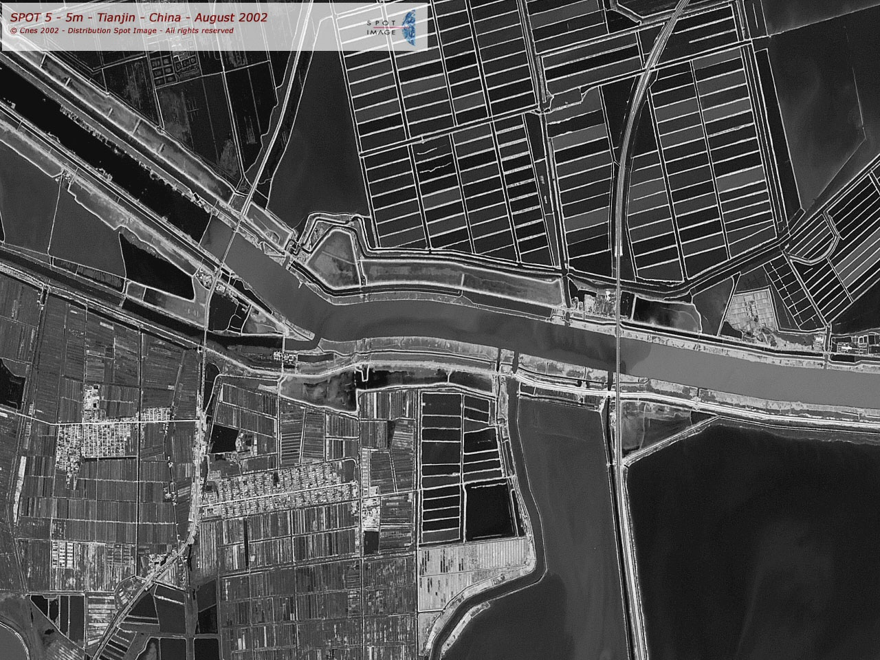 5m B&W Tianjin, China |
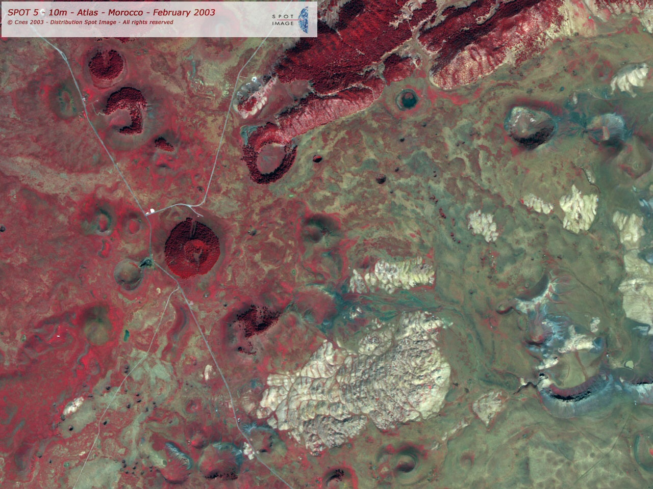 10m false color Atlas, Morocco |
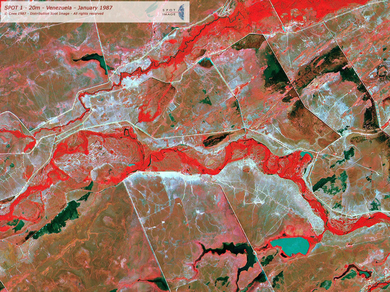 20m false color Venezuela |
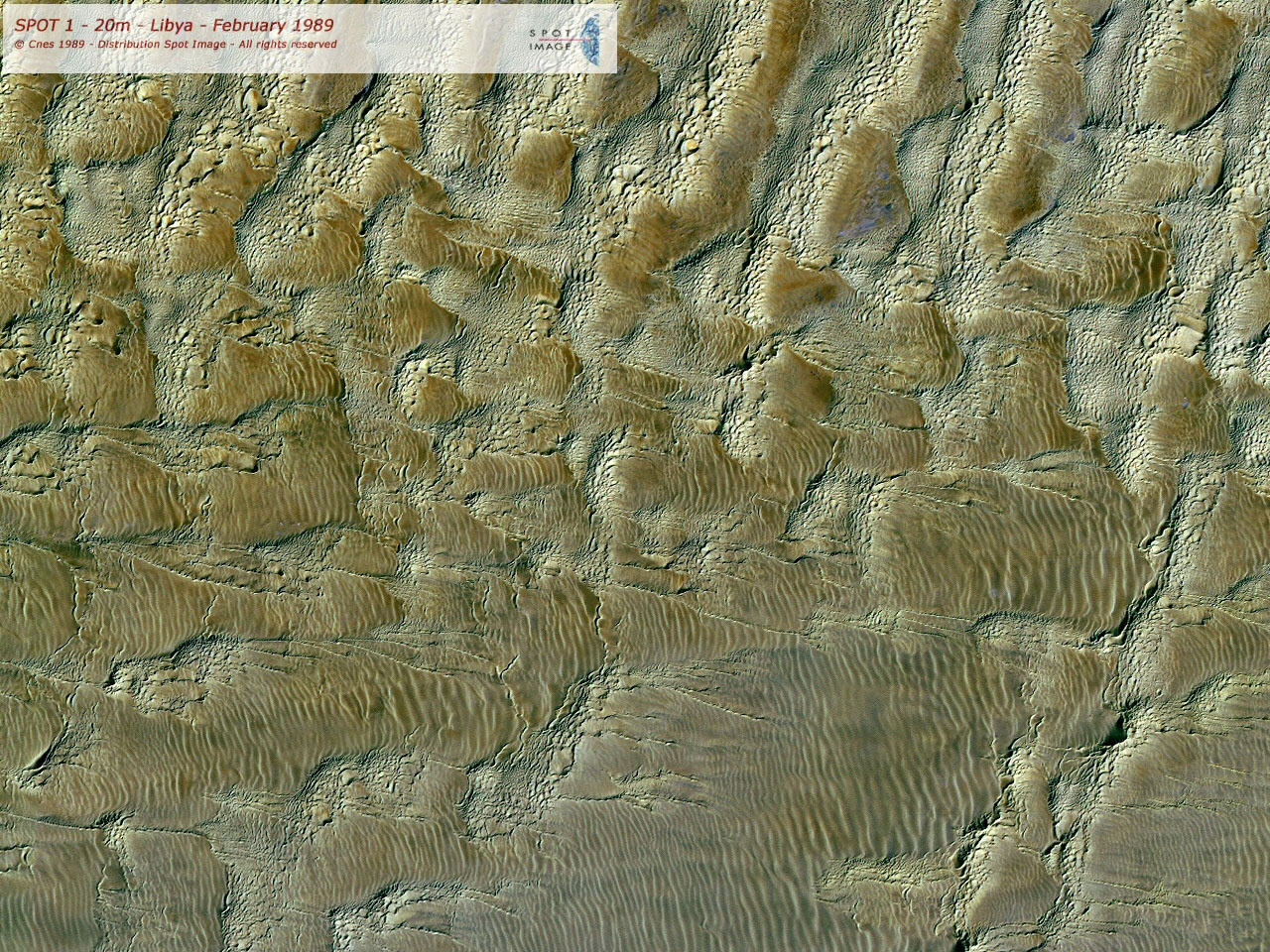 20m true color Libya |
Useful Web Sites
See above.
Technical Specs
| Spectral and resolution characteristics of data products | ||||
|---|---|---|---|---|
| Satellite(s) | Instrument | Band name | Spectral coverage | Pixel size |
| SPOT 1-3 | HRV | Panchromatic | 0.50-0.73 nm | 10m |
| B1: green | 0.50-0.59 nm | 20m | ||
| B2: red | 0.61-0.68 nm | 20m | ||
| B3: near IR | 0.78-0.89 nm | 20m | ||
| SPOT 4 | HRVIR | Monospectrala | 0.61-0.68 nm | 10m |
| B0b | 0.43-0.47 nm | Unspecified | ||
| B1: green | 0.50-0.59 nm | 20m | ||
| B2: red | 0.61-0.68 nm | 20m | ||
| B3: near IR | 0.78-0.89 nm | 20m | ||
| B4: mid IR | 1.58-1.75 nm | 20m | ||
| Vegetation 1 | B0+B2+B3+B4 | 1 kilometerc | ||
| SPOT 5 | HRG, HRS |
Panchromatic | 0.48-0.71 nm | 2.5m or 5m |
| B0b | 0.45-0.52 nm | Unspecified | ||
| B1: green | 0.50-0.59 nm | 10m | ||
| B2: red | 0.61-0.68 nm | 10m | ||
| B3: near IR | 0.78-0.89 nm | 10m | ||
| B4: mid IR | 1.58-1.75 nm | 20m | ||
| Vegetation 2 | B0+B2+B3+B4 | 1 kilometerc | ||
| Notes:
aThe monospectral band apparently has the same bandwidth as B2, but with 10m pixel resolution. bThe B0 band is apparently not available as a separate data product, but rather is exclusively for use in creating the "Vegetation 1" and "Vegetation 2" data products. cData swath is 2250 km wide. |
||||
There is a certain degree of image manipulation "magic" in some of the data products from spotimage.com.
For example, in the SPOT 5 satellite, there are two panchromatic detectors with 5m resolution; the data streams from these two
instruments are combined and
interpolated into a single 2.5m resolution product. This is quite valid, although there are probably processing artifacts which
would make the product slightly more suspect than a true 2.5m resolution product. Also, the user should know that
many of the image products are "pansharpened". Any 10m color image product from SPOT 1-4, or 2.5m-5m color
product from SPOT 5, would be the result of this image processing.
Spot Image data is available in several levels of processing. They are described below. The text is more or
less lifted directly from the Spot Image web site.
- Level 1A
- Radiometric correction of distortions due to differences in sensitivity of the elementary detectors of the viewing instrument. Intended for users who wish to do their own geometric image processing.
- Level 1B
- Radiometric correction identical to that of level 1A. Geometric correction of systematic effects (panoramic effect, Earth curvature and rotation). Internal distortions of the image are corrected for measuring distances, angles and surface areas. Specially designed product for photo-interpreting and thematic studies.
- Level 2A
- Radiometric correction identical to that of level 1A. Geometrical correction done in a standard cartographic projection (UTM WGS84 by default) not tied to ground control points. Allowing for possible differences in location, this product is used to combine the image with geographical information of various types (vectors, raster maps and other satellite images).
- Level 2B (Precision)
- This product comes in a map projection with ground control points taken on maps or from GPS type measurements taken in the field. The image is corrected for a mean elevation in a projection and a standard map frame. This product is used when deformations due to relief are not that important (flat ground, etc.).
- Level 3 (Ortho)
- Map projection based on ground control points and a DEM (digital elevation model) based on Reference3D data to eliminate distortions due to relief.
References
http://www.spotimage.fr/automne_modules_files/standard/public/p229_fileLINKEDFILE_Spot_payload.pdf--accessed 26 October 2004
http://www.spotimage.fr/automne_modules_files/standard/public/p229_fileLINKEDFILE_satp_en.pdf--accessed 26 October 2004
http://www.spotimage.fr/automne_modules_files/standard/public/p336_fileLINKEDFILE_Price_List_2004.pdf--accessed 26 October 2004